

 State Line Trail #738
Dry Creek Road #342 to Cedar Creek Road #320
Hike Distance: 11.0 miles
Hike Time: 6 to 7 hours
Elevation Gain: 1236 ft
Difficulty: Moderate
Travel Time to Trailhead: 1 hour from Superior
Summary:
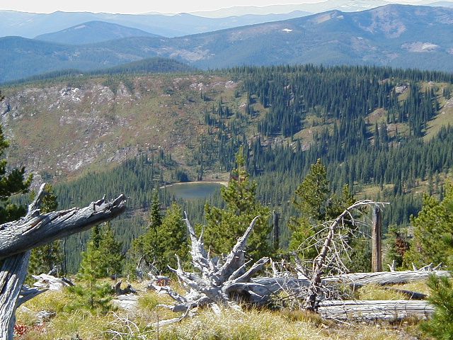
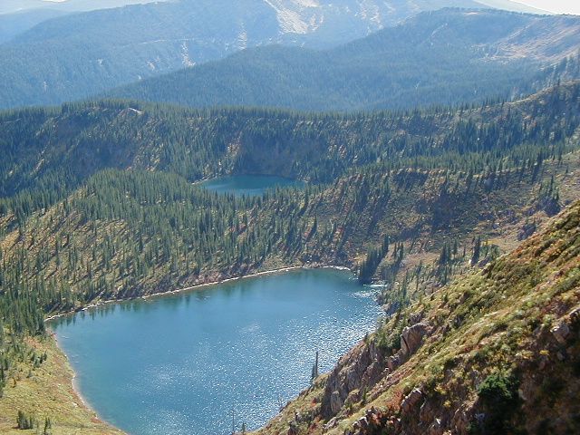
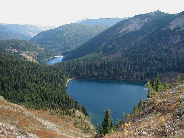
This is an extremely scenic hike along the ridgeline between Montana and Idaho with amazing overlooks along the entire hike including birds eye views of Cliff Lake, Diamond Lake, Dry Creek Drainage, Frog Lake, and the two Bonanza Lakes. It is advisable to drop a second car or arrange a pick up at the Cedar Creek Road Trial Head at the other end.
Trail Overview:
This is an 11 mile segment of the State Line Trail following the bitterroot divide. This is only a section of a larger trail which was constructed by the newly formed Forest Service in 1908; the entirety of the original trail running from Fish Lake to Ward Peak. It is known as the State Line Trail #738. It is a well-groomed horse trail along its entire path. This section has since been designated as non-motorized.
The Native Americans traveled this route in search of the White Bark Pine Nuts and other food sources as many as 3500 years ago.
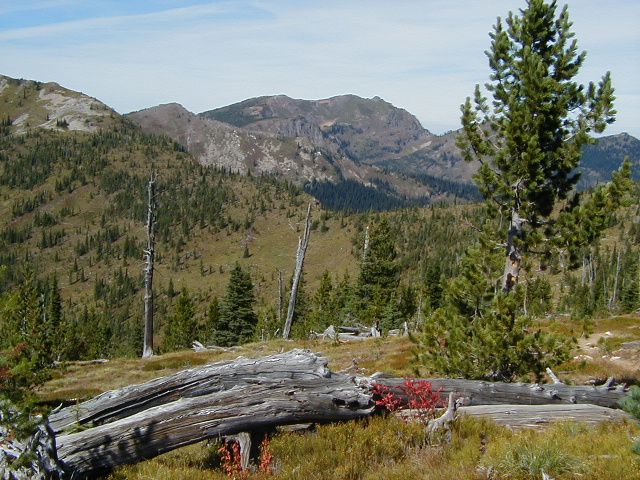
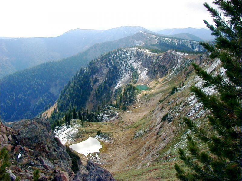
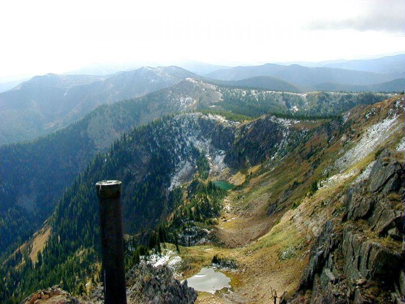
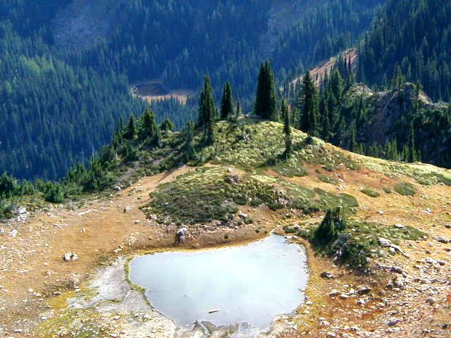
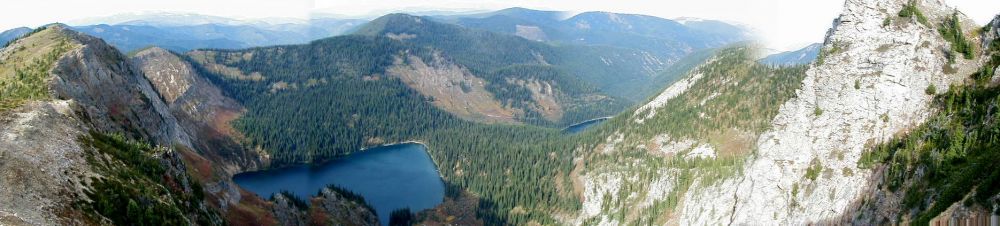
The 1910, fire burned this area leaving it almost void of timber therefore providing spectacular views from almost every step of this trail, including six glacial lakes located in the basins a few hundred feet below the divide.
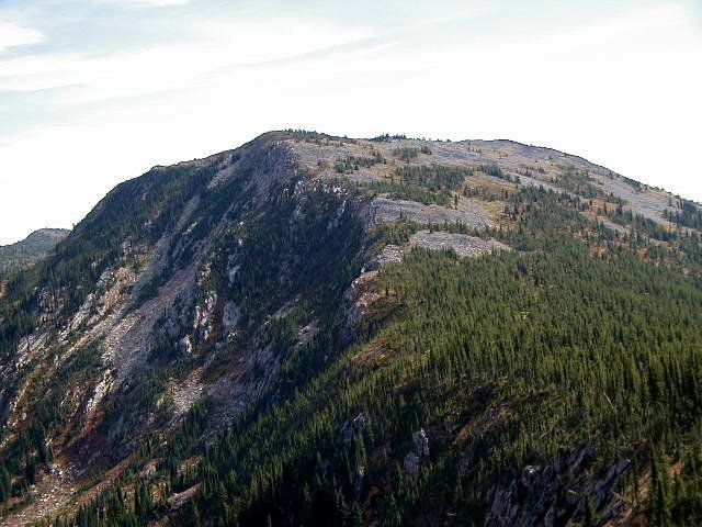
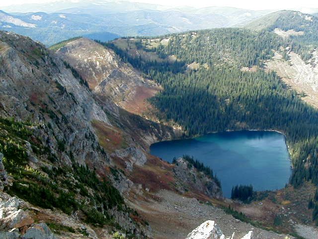
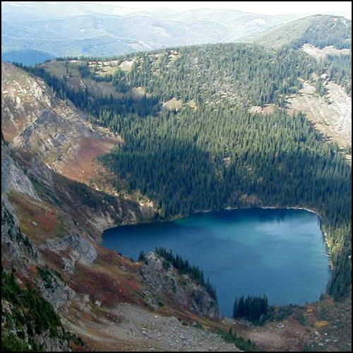
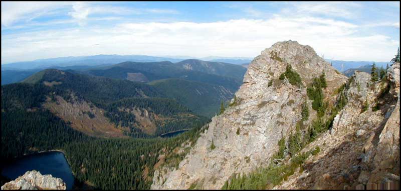 Cliff Lake & Rock Peak from Eagle Cliff - Jim Cyr
Trail Statistics:
From the Trailhead on Dry Creek Rd the trail follows the ridge through dense timber with very little grade change for the first 0.3 mile, then ascending for the next 0.5 mile into a saddle with views of Torino Peak rising above to the north and Dry Creek Rd circling through the valley far below it on the left.
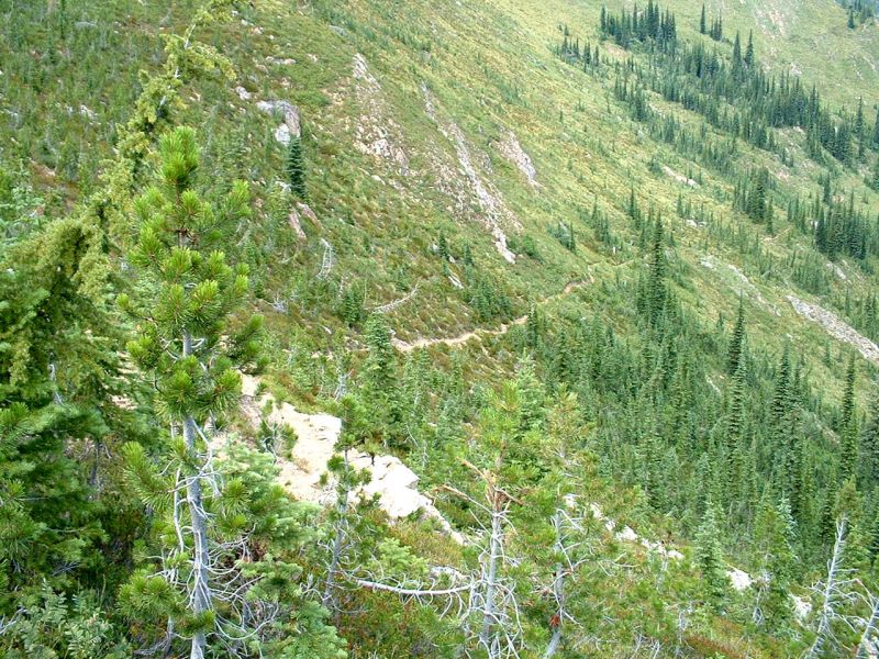
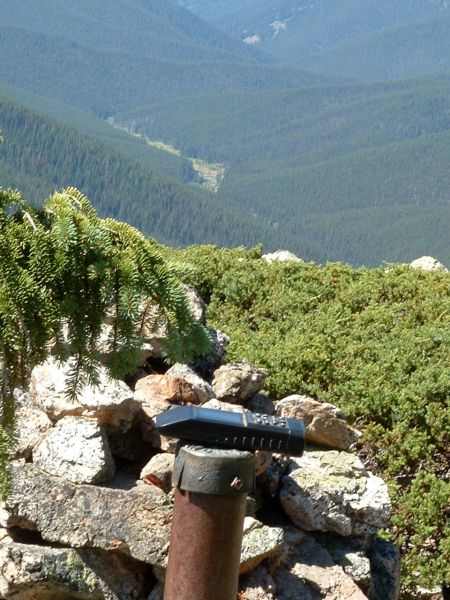
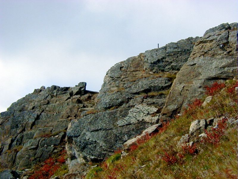
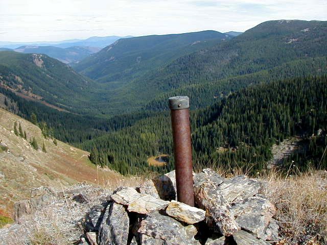
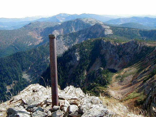
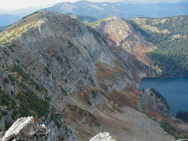
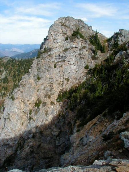
The trail then traverses up and down on the Idaho side of the ridge coming out of the trees with a clear view of Cliff and Diamond Lakes. Cliff Lake lays eight hundred feet below and is set in a glacial cirque at the base of looming cliffs. To the right is a panoramic view into Idaho with an overlook of the St Joe River Drainage. The trail then circles around the Idaho side of the cliffs above Cliff Lake and comes out at another point with another view of Cliff Lake from the opposite side. Looking the southward direction you will see Eagle Cliff rising on the ridge above you. The trail then skirts around the below Eagle Cliff to a ridge on the divide between Cliff Lake and the South Fork of Dry Creek. From here you can look down on views of potholes in the basin which is the headwater of South Fork of Dry Creek. Follow the ridge on your left, this is a well worth side trip of 0.2 mile up the ridge to Eagle Cliff with a spectacular view overlooking Cliff Lake. Words cannot describe the solitude I feel as I sat alone at the top of Eagle Cliff, absorbing the beauty, which is so beautifully laid out before me. The only evidence of civilization is the past logging off in the distant mountain. You will discover a state line monument marker with an elevation of 7552 feet at the peak. The only sound to disturb the quite of nature is an occasional airplane high overhead. Although the busy I-90 freeway in the valley below is less then 20 miles distance, no sight or sound of it is evidenced here.
Returning back to the State Line Trial follow the ridge to where the Dry Creek Trail #151 ends. Binocular Peak looms ahead. Circling around Binocular Peak the trail passes above and near Frog Lake on your right.
Continuing back to the State Line Divide to a saddle, which is the end of Lost Creek Trail #112. Views are down the Lost Creek Drainage to the left. The trail then ascends to a point above the Bonanza Lakes with views of both lakes. While descending down the ridge to the Bonanza Lake Trial #616 to your right you will see an old mine in the valley far below. Continuing around the hillside to the trailhead at Cedar Creek Road.
Getting There:
From Superior get on Interstate 90 heading West. Go 4 miles and get off Dry Creek Rd Exit #43. Turn left under interstate. Turn right at 0.8 miles onto Dry Creek Rd #342. Reset odometer to 0 at this this point. The payment ends at 0.5 miles. At 9.6 miles road forks, keep on right fork of the road (the other road goes to Diamond Lake). At 15.4 miles road forks again, but you want to continue straight ahead. At 19.3 miles you will be at the top, this is the State Line and you can park. There is plenty of parking spacee, enough even to turn a large trailer around. Will not see the trailhead at first, but the trailhead is actually between the main road and the gated logging road on the left. You will see the trail sign about 50 to 100 feet back from road.
Approximately 1 hour driving time from Superior for a total of 24.3 miles.
![]()
![]()
![]()


