default_mobilelogo

The Trails

State Line Trail #738 - Dry Creek Road #342 to Cedar Creek Road #320

uphill hiking iconscenic view iconscenic photographic icon

Hike Distance: 11.0 miles

Hike Time: 6 to 7 hours

Elevation Gain: 1236 ft

Difficulty: Moderate

Travel Time to Trailhead: 1 hour from Superior

Summary:  This is an extremely scenic hike along the ridgeline between Montana and Idaho with amazing overlooks along the entire hike including birds eye views of Cliff Lake, Diamond Lake, Dry Creek Drainage, Frog Lake, and the two Bonanza Lakes.


STATE LINE TRAIL #738 - Hoodoo Pass to North Fork of Fish Creek #103

Looking down on Pearl Lake with crystal blue water and wildflowers blooming in the foreground.

uphill hike iconfishing iconscenic view iconphotographic view icon

Hike Distance: 3 to 6 miles

Hike Time:  2 to 7 hours

Elevation Gain: 1300 ft

Difficulty: Moderate

Travel Time to Trailhead: 1 hour from Superior

Summary: This is an extremely scenic hike along the ridgeline between Montana and Idaho with amazing overlooks along the entire hike including birds eye views of Hidden, Hoodoo and Heart Lakes.  Can also be done as a full day hike descending into Dalton Lake and coming out at the lower Heart Lake trailhead.  Very aromatic and spectacular when in bloom with wild flowers.


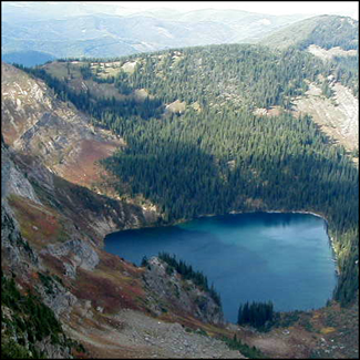
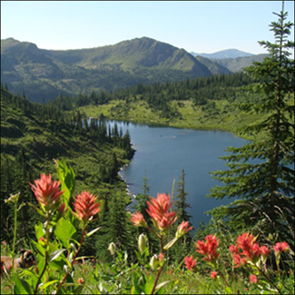
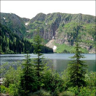
Heart Lake Trail #171

uphill hiking iconfishing iconscenic view icon

Hike Distance: 8.4 miles

Hike Time: 6 hours

Elevation Gain: 983 feet

Difficulty: Moderate

Travel Time to Trailhead: 45 minutes from Superior

Summary: The trail follows along the South Fork of Trout Creek, through a dense timber forest to the base of Heart Lake, a beautiful lake surround by cliffs. The trail then climbs steeply to the State Line Trail with scenic views of Heart Lake and Pearl Lake with Lightening Peak in the distance.